![](/images/other/stat-length.png)
![Tour Wandern West Cork - Ardgroom - Eyeries - Photo](https://media.geolcdn.com/t/1900/400/f2dadcd9-fbef-450a-b0bf-16b934d19a3c.jpg&format=pjpeg&maxdim=2)
Ardgroom - Eyeries
Geert H.
Benutzer
![Länge](/images/other/stat-length.png)
Länge
15,6 km
![Maximale Höhe](https://static1.geolcdn.com/siteimages/upload/files/1508320355ic_sort_altitude_max_24dp.png)
Maximale Höhe
107 m
![Positive Höhendifferenz](https://static1.geolcdn.com/siteimages/upload/files/1508320355ic_sort_den_pos_24dp.png)
Positive Höhendifferenz
229 m
![Km-Effort](/images/other/stat-length.png)
Km-Effort
18,6 km
![Min. Höhe](https://static1.geolcdn.com/siteimages/upload/files/1508320355ic_sort_altitude_min_24dp.png)
Min. Höhe
2 m
![Negative Höhendifferenz](https://static1.geolcdn.com/siteimages/upload/files/1508320355ic_sort_den_neg_24dp.png)
Negative Höhendifferenz
213 m
![Boucle](https://static1.geolcdn.com/siteimages/upload/files/16400158638029165_repeat_loop_refresh_sync_direction_icon.png)
Boucle
Nein
Erstellungsdatum :
2024-08-15 08:45:46.974
Letzte Änderung :
2024-08-23 10:14:57.866
![Wandern](https://static1.geolcdn.com/sitytour/trail-icons/101.png)
3h48
Schwierigkeit : Medium
![Scannen Sie diesen QR-Code, um die Tour in der SityTrail-Anwendung zu öffnen](https://capi.geolives.com/qq0zvz2zws4bq2lad0pu/sitytour/trails/4156446/qr.png?size=200)
Kostenlosegpshiking-Anwendung
Über SityTrail
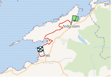
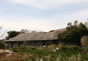
Tour Wandern von 15,6 km verfügbar auf Unbekannt, County Cork, West Cork. Diese Tour wird von Geert H. vorgeschlagen.
Beschreibung
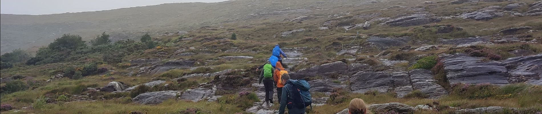
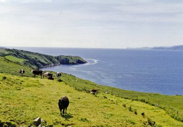
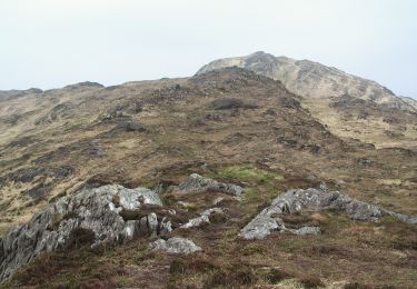
A substantial climb takes us from Ardgroom to the rock plateau and then we descend to Lough Kadda.
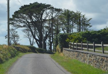
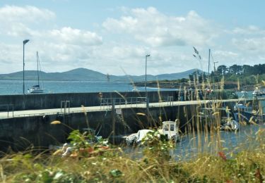
The rest of the trip is mainly along the deeply indented coastline until Eyeries
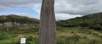
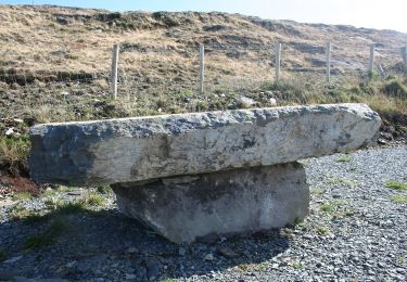
Ort
Land:
Ireland
Region :
Unbekannt
Abteilung/Provinz :
County Cork
Kommune :
West Cork
Standort:
Kilcatherine
Gehen Sie:(Dec)
Gehen Sie:(UTM)
438062 ; 5731960 (29U) N.
Kommentare
Touren in der Umgebung
![Tour Zu Fuß West Cork - Foilakilly Loop - Photo](https://media.geolcdn.com/t/375/260/b3aff1b4-469f-4f4e-be15-0bdb8a90424e.jpeg&format=jpg&maxdim=2)
![Zu Fuß Zu Fuß](https://static1.geolcdn.com/sitytour/trail-icons/100.png)
Foilakilly Loop
Zu Fuß
Einfach
West Cork,
Unbekannt,
County Cork,
Ireland
![](/images/other/stat-length.png)
9,6 km | 13,4 km-effort
3h 3min
![](https://static1.geolcdn.com/siteimages/upload/files/16400158638029165_repeat_loop_refresh_sync_direction_icon.png)
Ja
![Tour Zu Fuß West Cork - Gortnakilly Loop - Photo](https://media.geolcdn.com/t/375/260/642e0f67-e469-457d-8c22-f45f9cb7baf3.jpeg&format=jpg&maxdim=2)
![Zu Fuß Zu Fuß](https://static1.geolcdn.com/sitytour/trail-icons/100.png)
Gortnakilly Loop
Zu Fuß
Einfach
West Cork,
Unbekannt,
County Cork,
Ireland
![](/images/other/stat-length.png)
7,8 km | 11 km-effort
2h 30min
![](https://static1.geolcdn.com/siteimages/upload/files/16400158638029165_repeat_loop_refresh_sync_direction_icon.png)
Ja
![Tour Zu Fuß West Cork - Glanlough Loop - Photo](https://media.geolcdn.com/t/375/260/daf5f9ee-36ca-4c74-b725-c302cdc1d3e4.jpeg&format=jpg&maxdim=2)
![Zu Fuß Zu Fuß](https://static1.geolcdn.com/sitytour/trail-icons/100.png)
Glanlough Loop
Zu Fuß
Einfach
West Cork,
Unbekannt,
County Cork,
Ireland
![](/images/other/stat-length.png)
14 km | 19,6 km-effort
4h 26min
![](https://static1.geolcdn.com/siteimages/upload/files/16400158638029165_repeat_loop_refresh_sync_direction_icon.png)
Ja
![Tour Zu Fuß West Cork - Peakeen Ridge Loop Walk - Photo](https://media.geolcdn.com/t/375/260/60ced130-bccc-42da-b44d-930e68129354.jpeg&format=jpg&maxdim=2)
![Zu Fuß Zu Fuß](https://static1.geolcdn.com/sitytour/trail-icons/100.png)
Peakeen Ridge Loop Walk
Zu Fuß
Einfach
West Cork,
Unbekannt,
County Cork,
Ireland
![](/images/other/stat-length.png)
10,8 km | 15,1 km-effort
3h 25min
![](https://static1.geolcdn.com/siteimages/upload/files/16400158638029165_repeat_loop_refresh_sync_direction_icon.png)
Ja
![Tour Zu Fuß West Cork - Caher Loop Walk - Photo](https://media.geolcdn.com/t/375/260/239ad555-544a-4a9b-9726-abf0de7ba208.jpeg&format=jpg&maxdim=2)
![Zu Fuß Zu Fuß](https://static1.geolcdn.com/sitytour/trail-icons/100.png)
Caher Loop Walk
Zu Fuß
Einfach
West Cork,
Unbekannt,
County Cork,
Ireland
![](/images/other/stat-length.png)
5,6 km | 8 km-effort
1h 49min
![](https://static1.geolcdn.com/siteimages/upload/files/16400158638029165_repeat_loop_refresh_sync_direction_icon.png)
Ja
![Tour Zu Fuß West Cork - Cahergal Loop Walk - Photo](https://media.geolcdn.com/t/375/260/ce478dcc-cb35-4555-be41-74d6cfec757f.jpeg&format=jpg&maxdim=2)
![Zu Fuß Zu Fuß](https://static1.geolcdn.com/sitytour/trail-icons/100.png)
Cahergal Loop Walk
Zu Fuß
Einfach
West Cork,
Unbekannt,
County Cork,
Ireland
![](/images/other/stat-length.png)
8,5 km | 12 km-effort
2h 43min
![](https://static1.geolcdn.com/siteimages/upload/files/16400158638029165_repeat_loop_refresh_sync_direction_icon.png)
Ja
![Tour Zu Fuß West Cork - Mass Path Linear Walk - Photo](https://media.geolcdn.com/t/375/260/5f02adc8-2f3b-4d27-8c1a-931d8f80f7ab.jpeg&format=jpg&maxdim=2)
![Zu Fuß Zu Fuß](https://static1.geolcdn.com/sitytour/trail-icons/100.png)
Mass Path Linear Walk
Zu Fuß
Einfach
West Cork,
Unbekannt,
County Cork,
Ireland
![](/images/other/stat-length.png)
4,5 km | 6,3 km-effort
1h 25min
![](https://static1.geolcdn.com/siteimages/upload/files/16400158638029165_repeat_loop_refresh_sync_direction_icon.png)
Nein
![Tour Zu Fuß West Cork - Seefin Loop - Photo](https://media.geolcdn.com/t/375/260/5f02adc8-2f3b-4d27-8c1a-931d8f80f7ab.jpeg&format=jpg&maxdim=2)
![Zu Fuß Zu Fuß](https://static1.geolcdn.com/sitytour/trail-icons/100.png)
Seefin Loop
Zu Fuß
Einfach
West Cork,
Unbekannt,
County Cork,
Ireland
![](/images/other/stat-length.png)
12 km | 17,2 km-effort
3h 54min
![](https://static1.geolcdn.com/siteimages/upload/files/16400158638029165_repeat_loop_refresh_sync_direction_icon.png)
Ja
![Tour Zu Fuß West Cork - Barán Loop - Photo](https://media.geolcdn.com/t/375/260/5f02adc8-2f3b-4d27-8c1a-931d8f80f7ab.jpeg&format=jpg&maxdim=2)
![Zu Fuß Zu Fuß](https://static1.geolcdn.com/sitytour/trail-icons/100.png)
Barán Loop
Zu Fuß
Einfach
West Cork,
Unbekannt,
County Cork,
Ireland
![](/images/other/stat-length.png)
7,7 km | 11,7 km-effort
2h 39min
![](https://static1.geolcdn.com/siteimages/upload/files/16400158638029165_repeat_loop_refresh_sync_direction_icon.png)
Ja